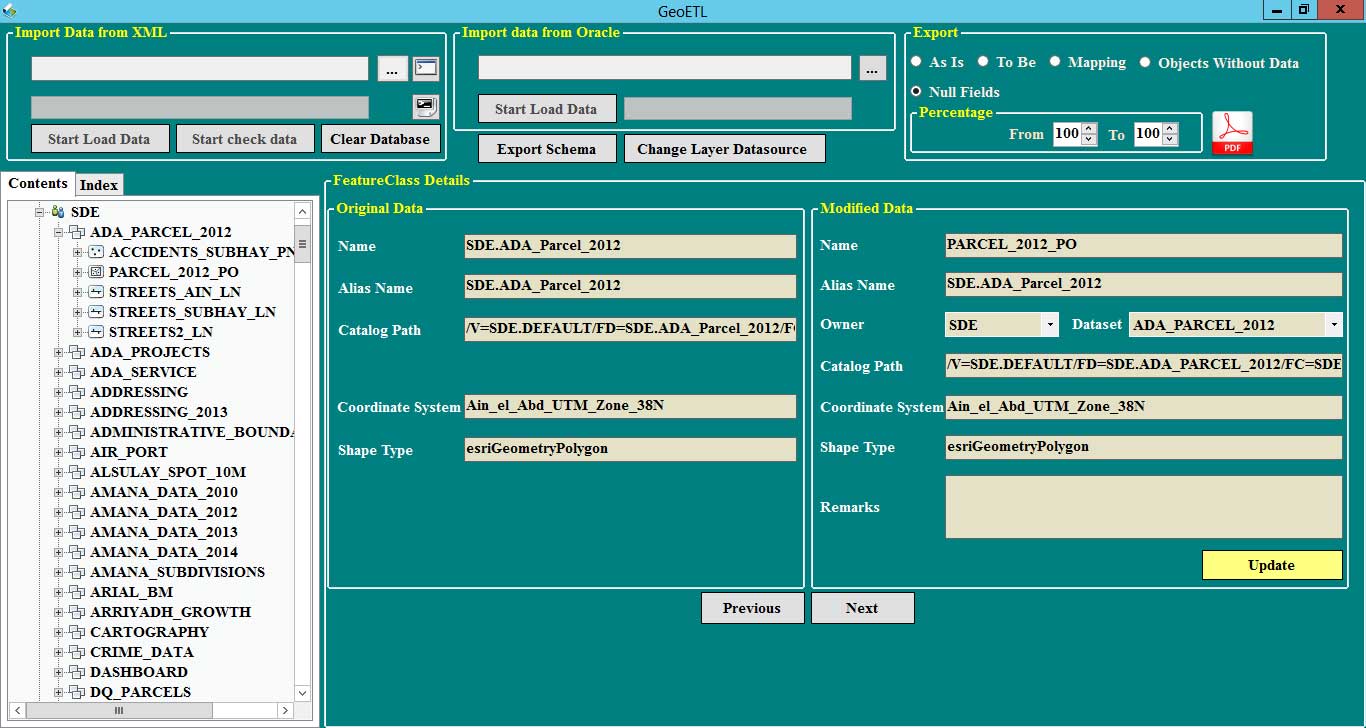
GEO ETL stands for "Geographic Extract, Transform, and Load." It is a specialized application for processing geographic data, extracting data from various sources (such as different databases and multiple file types), transforming it into the required format, and then loading it into the target system. It was developed to automate data transfer processes, easily modify geographic data structures, create clear data mapping, and automatically generate Python scripts for data transfer, making integration with other systems much easier.
How to link XML files created by SDE to an Oracle database and compare the data between them. Ability to display geographic data in a tree structure, just like ArcGIS. This feature helps understand data relationships and facilitates analysis. Modify the schema by creating, updating, or deleting data. Improve database performance by removing empty values from old templates. Validate and ensure infrastructure data compliance with object naming rules. Are the element names used in the site or application written in English only and free of special characters? A powerful search engine to find any element within the data model.
© VOTechnology. 2025. All rights reserved.